
Drawings should use automatic drawing titles. The default behavior of such titles is to use the name of the view, which comes from the name of the viewpoint. Name the viewpoint with the text you wish to see on the paper; then everything takes care of itself.
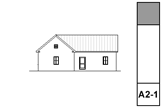
The ID should be the approximate sheet number. This is only to help organize the project map and view map. The ID is never used in output. Elevations should use A2-1 and A2-2, etc., and the section IDs begin after them. If you are using a direction code to help tell the sections apart, put that code in the ID, not in the name. Example: A2-4U, A2-6R.
Sections and elevations are never drawings. If the model can't deliver correct output while staying live, improve your modeling. Auto-rebuild is fine for projects of our scale. We never use independent sections or elevations. (If you see independent S/E viewpoints, this is likely buggy behavior. Get rid of these viewpoints, copying 2D content out if needed.)
+Z SE Hide is the default layer for all. This layer shows in model combinations and is hidden in plan. +Z SE Print shows in plan. In the templates, all the S/Es are on the Hide layer. When the time comes that you want to see the marker of a given S/E in plan, move that marker to the Print layer.
I find it helpful to color-code S/Es by function:
Exterior elevations: 122 (purple)
Long sections: 32 (green)
Cross sections 62 (orange)
Interior elevations: 82 (cyan)
Wall sections: 42 (blue)
Sometimes you have to cut a section just to generate a detail; I use pen 52 (dark red) for those.
Current markers are Elevation Marker JM18, Section Marker JM18, and for junk sections Plain Section JM11.
Marker extents should kept near the building; we don't want a lot of empty land around the building. It's OK to extend the marker a little to get it clear of dimensions.
Elevations should be as close to the building as possible; step the marker where necessary to achieve this. Watch out for eaves and gutters.
Sections often require a lot of tweaking to get them to cut through interesting/clear/consistent stuff on all stories. Try not to cut through walls lengthwise. Watch for undesirable effects of stepping with respect to roofs. Where a section cut is perpendicular to a roof's slope, try to avoid stepping the section within that roof. If you can't avoid it, discontinuities in the roof can be patched, but the patch becomes a maintenance issue if you edit the S/E element again.
Section depth should be minimized in order to improve application performance. The depth should reach only the most distant element you want to see; usually it's a ridge or a chimney. Never use infinite depth sections. Zero-depth sections come in handy sometimes for generating details, but building and wall sections should always have some depth. S/E marker depth is an On-Screen Option. Toggle the display of depths using the toolbar button.
For sections, make sure the Z-height of the bottom is below the deepest footing by about a foot. This may vary among the sections. For elevations, the bottom should be a couple feet below the lowest part of the grade line.
When viewpoints are created, they should refer to the viewpoint. In this mode, the markers show the view ID and name in invisible red text. Once a drawing is placed in a layout, change this to refer to the first placed drawing of the viewpoint. The text in this mode is the marker color. If you see #DrgID/#LayID, that means a drawing hasn't been placed.
All annotations go on the layer +A Arch Note Reg Scale. This includes text, arcs and splines used for leaders, and notation objects. All added 2D work should go on +A Misc Line, but this is not a critical issue. Since S/E viewpoints usually only generate a single view, layer discipline is not as important as in the plan. You should, however, make consistent use of the Arch Note layer, to maintain the option of turning the notes off to display the S/E image by itself.
Elevation (and 3D) hatching is generated by the 'Vectorial Hatching' setting of the surface in Options -> Attribute Settings -> Surfaces. The pen of the hatching should typically be 150, which is light gray. Never use the element pen - it is too heavy. Display of the hatching is a setting in the model tab of the S/E marker itself.
Get really good at modeling. A near-perfect elevation is minimal competence in Archicad. That said, some lines just won't die.
Ugly bits which are complex can be patched. To hide simple cases of a few unwanted lines, use a fill which matches the vectorial hatching of the elements involved (shingles, stone, etc.), and has an opaque background. For blank walls you can use a solid fill of a white-printing pen. I use 80, which is purple, so I can see the areas I've masked. You can also try the white-out pens, 181-186. (Their weights match the typical weights.) They work well, but I still like the purple/white fills because I can see them. Masking fills, lines and patches should go on the layer +A Misc Line. The use of masking elements becomes a maintenance issue.
Use Marked Distant Area where appropriate. When using it, check 'Use One Pen' and use pen 30. Pen 30 is gray in AC and 1-weight black in layouts. You need section depths on in on-screen options to edit the MDA depth. Don't forget the toolbar button.
Foreground elements can be outlined with a heavy (4-weight) polyline. (There's a favorite for this.) There is no reliable way to do this automatically, it's tedious. One tip: for symmetrical building parts, outline one half and then mirror. Another: Outlines can often be copied and pasted to the opposite-facing elevation and mirrored across the global origin.
Outlining is a quaint graphical tradition that I expect to fade away. It does not make the drawing read better, unless you outline every different plane. We are moving away from manual 2D enhancement of output, but I left this part in anyway for now. If you must outline, put it off as long as possible.
The ground mesh section settings should be: Building material='Earth'; Background pen=91; Foreground pen=37; Cut pen=36. The cut pen is extra heavy. The foreground pen turns white (invisible) in building sections, and black in wall sections.
Use labels. We don't text blocks with polylines anymore. For multiline texts, the leader doesn't line up with the first/last line, but that's too bad. Another graphical fussiness that can be let go.
Mouldings and many objects can be labelled automatically with the label General Element Label JM20. The Description option will call out the basic identity of many objects such as railings and decorative columns. The Moulding option is specifically for moulding objects such as crown, base, panels, etc. The independent Description label, currently version 19, also works.
Elevation notes. The main materials and building elements should be noted. This includes wall finishes, trim parts, decorative columns, panels, railings, chimneys, etc. Notes on the right side should be left-justified. Notes on the left side should be right-justified.
Knee wall heights should be dimensioned in section.
In sections, unusual ceiling or floor conditions may be labeled with Slab Elev JM10. Examples: Lowered ceilings in small rooms, a stepped slab in a theater.
Roof pitches should be noted in section and elevation with the label Roof Slope JM10.
Doors and windows should be labeled with Door-Window Label JM16.
Structural members in section should be labeled with description labels as described above. Joists are shown 2D-only using 'Joists Sect 2D JM16'. Our standards don't support modeling the joists.
Story levels should be shown, except for the Roof and -2 junk story. If elevation bottom Z-heights are set correctly, you should not see the basement story marker if you can't see the basement.
For levels other than story levels, use the object Elev Marker JM19. In sections, levels should be should be shown for ceilings as well as floors, and for interior floor level changes (such as garage slabs). Level objects will auto-display their Y position, which is the height above zero. They should be dimensioned to show the relationships among them.